Collections

ARLIS atrium and map collection

Special Collections

With half of the ARLIS collections consisting of archival materials, the vast majority of which has never been seen by the public, there is a hidden archive within ARLIS that reflects the rich history of Alaska’s natural and cultural resources. The Archive contains original and rare materials pertaining to the natural and cultural heritage of Alaska and spans more than a century. It includes a variety of material types and formats: photograph negatives, prints, slides, 8mm and 16mm films, field notebooks, reports, folios, scrapbooks, manuscripts, hand annotated maps, overlays, and transparencies. Taken together, the Archive includes hundreds of collections from federal and state agencies, which represents the vast and variegated history of Alaska’s land, people, and resources.

Future Exhibitions

Carefully curated exhibitions will highlight materials from the Archive and Special Collections. Displaying rare and original items alongside recent research findings, the exhibitions will focus on efforts to document and conserve Alaska’s natural resources past, present, and future, which will facilitate public engagement and understanding of the value of the historically diverse collections across ARLIS.

Collection Materials Viewing Room

Visiting researchers will be provided a room for viewing archival, rare, and Special Collections materials with staff oversight.

Browse Collection Guides

Special Collections Areas

Archives & Rare Books

Nearly half of the ARLIS collection is comprised of archival records, including administrative documents, aerial photographs, field notes, multimedia material, and more. Finding aids for archival materials are in development. To access material in the Archive, please contact reference@arlis.org.

Contact ARLIS

Rare Books

ARLIS holds a small collection of rare books dating from the late 19th to the 21st century. A full catalog and access policies for rare books is in development. To access material in the Rare Book Room, please contact reference@arlis.org.

Contact ARLIS

Maps and Atlases

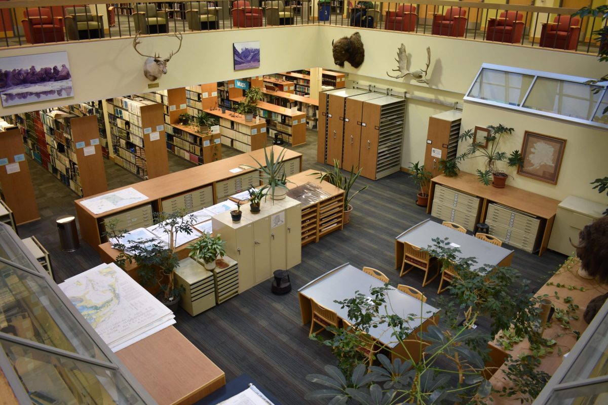
ARLIS holds an extensive collection of maps and atlases, many of which are unique and unavailable elsewhere in the world. Items in the map atrium are available to users during open hours.

Search Maps & Atlases

Hidden Collections

While the ARLIS catalog contains thousands of useful resources, there are many hidden collections which have not yet been fully cataloged. Some of these are located in the Archives and Rare Books collections, while others have been compiled into curated sub-collections and are more difficult to find. Browse the hidden collections below or explore the Collection Guides to learn more about the hidden collections pertaining to specific subject matter.

Historic Fishery Reports

Location: Special Collections

Since Alaska-statehood in 1959, this regionally-based series from the Alaska Department of Fish and Game compiled data in a cumulative manner for catch, escapement, economic factors, and fishery management policies for each regional commercial fishery.

The reports, prepared for the Board of Fisheries, were not widely distributed and ARLIS has the most complete collection in the state. The information is meant for a general audience and is often used by consultants and industry watchers to compare fisheries from one year to another.

The reports are shelved by geographic region from east to west across Alaska and by year within geographic region.

Historic Refuge Reports

Location: Special Collections

These reports, prepared at National Wildlife Refuges throughout Alaska, describe personnel, projects, and activities at each refuge. Many reports contain photographs and maps and are a rich source of history of the refuge.

ARLIS circulates only photocopies of these reports, due to irreplaceable photographs included in source documents.

A digital edition of these narratives is in preparation.

Alaska Fish Passage Studies & Reports

This collection contains papers on fish passage that date from 1960 to the 2010s, and represent federal and state documents, theses, and consultant reports. These documents cover hydrology, fish swimming performance, barriers to movement of fish, fish ladders, and other passage structures (such as bridges), but there is particular emphasis on salmonids and culverts in Alaska. The papers had been compiled by staff of Alaska Department of Fish and Game, Division of Sport Fish, Research and Technical Services, to provide an easily accessible source of the classic fish passage literature, all of which are still relevant to modern development projects.

Search Fish Passage Reports

Federal Power Withdrawal Maps

The Federal Power Withdrawal Site collection is a unique set of original documents regarding U.S. federal land withdrawals and reservations in Alaska covering the periods before statehood and during statehood. These records, owned by the Alaska State Office of the Bureau of Land Management (BLM), document and substantiate important BLM statewide efforts, and represent an enormous body of work regarding the location, abundance, condition, and trend of aquatic and land resources. They may serve as back-up for future crucial BLM decisions regarding land withdrawals. This natural resource information and research also has value in illustrating real-time monitoring and assessment, designations, and decisions, especially in regard to federal power projects in Alaska, and preserves field work that cannot be duplicated.

Search Maps

OCSEAP Reports

The protection of the marine and coastal environment is mandated by the Outer Continental Shelf (OCS) Lands Act of 1953, the National Environmental Policy Act of 1969, and the OCS Lands Act Amendments of 1978. An essential responsibility of the Department of the Interior (DOI), as manager of the OCS Leasing Program, is to ensure that proposed OCS development and production activities will not irreparably damage the marine environment and its resources. To help meet this responsibility as it applies to development of the Alaska OCS, the Outer Continental Shelf Environmental Assessment Program (OCSEAP) was initiated by interagency agreement between DOI’s Bureau of Land Management (BLM, later Minerals Management Service, MMS, and still later, Bureau of Ocean Energy Management, BOEM) and the Department of Commerce’s National Oceanic and Atmospheric Administration (NOAA).

The ARLIS OCSEAP website provides access to a compilation of publications and reports that have resulted from research funded by OCSEAP since its inception in 1975. It was derived by ARLIS staff from the OCSEAP Comprehensive Bibliography, published June 1990.

Search OCSEAP Reports

Public Review Documents

Location: first row in Special Collections

ARLIS is typically the library of choice for government agencies and project managers to house documents that require public notice and review. Public Review Documents are accessible whenever the library building is open to the public, including evenings and weekends.

Items received for public review from state or federal agencies or other organizations are placed immediately on the Public Review Document shelves with minimal processing to provide ready public access. After the public comment period, items are returned to the donor or added to the collection according to donor preference.  Some items in this section are actually mini-collections available on a long-term basis. Others may be available in digital format.

These items are not in the catalog and are not available for checkout.  Items are shelved by geographic location and there is an index available on the shelf and online.

View Finding Aid