
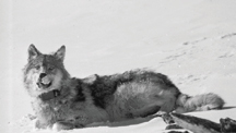
| Golden Eagle Populations. Native Americans legally harvest golden eagles for use in ceremonies. The Department of the Interior has the responsibility for determining the potential effects of this harvest on eagle populations. Wildlife biologists with the USGS are gathering data for use in developing a plan for monitoring population size. Objectives of the project include reviewing literature for information relevant to the current status of golden eagles in a chosen study area. USGS is soliciting information from Federal, State, Tribal, and non-government biologists for information about the biology of golden eagle populations and their opinions on the status of the species. USGS scientists will estimate the number of golden eagles in the study area using appropriate statistical methods. Contact: Mark Fuller, Forest and Rangeland Ecosystem Science Center, Snake River Field Station, 208-426-4115, mark_fuller@usgs.gov |
 |
Tribal Fisheries Enhancement.
The USGS Great Lakes Science Center's Tunison Laboratory of Aquatic Science continued assistance to local tribes in restoring and enhancing their fisheries. Tunison staff stocked 150 catchable rainbow trout (reared at the Tunison facility) in waters of the Onondaga Nation. Tunison scientists continued assisting The St. Regis Mohawk Tribe by examining the feasibility of restoring Atlantic salmon in St. Lawrence River tributaries. Salmon restoration activities included stocking 20,000 salmon fry in tributaries of the St. Regis and Salmon rivers and assessing survival through the fall and estimating overwinter survival of salmon fry stocked in July 1999 in St. Regis River tributaries. In addition, the Environmental Division of The St. Regis Mohawk Tribe and Tunison Laboratory are cooperating in a pilot project that focuses on the American Eel population in the St. Lawrence River. The project involves field collection of American eels, ecological assessments, and laboratory analysis of eel health and life history of this population. Contact: Great Lakes Science Center, 734-994-3331, nancy_m_milton@usgs.gov
Determining the Effect of Water Temperature on Lake Trout Predation by Sea Lampreys.
The USGS Great Lakes Science Center and the Chippewa-Ottawa Resource Authority have undertaken a cooperative research effort to investigate the effects of water temperature on sea lamprey predation of lake trout in Lake Huron. Bioenergetics, the study of energy exchanges within and between living things and their environment, will be used by USGS scientists to predict the mortality of lake trout by lamprey attacks in relation to water temperature. A by-product of this research effort would be a measurement of the effectiveness of international efforts to control sea lampreys in Lake Huron.
Lake trout have been tagged in an effort to determine daily and seasonal water temperature preferences. In cooperation with the Tribal Fisheries Management Authority, the first tagging phase began in 1998, and continued in the fall of 1999. A manuscript is in preparation that describes temperatures occupied by three strains of lake trout from fall 1998 through fall 2000. The Seneca Lake (New York) strain lake trout occupied significantly lower temperatures in summer 1999 than lake trout of Great Lakes origin. This supports earlier speculations that Seneca lake trout may be less vulnerable due to lower temperature and lower lamprey metabolism. The results of the study will benefit lake trout management and restoration programs in eight states, several Canadian provinces, and other Federal and Tribal agencies throughout the Great Lakes Basin. Contact: Great Lakes Science Center, 734-994-3331, nancy_m_milton@usgs.gov
Delineation of Contributing Area, Public Water Supply Wells, Keweenaw Bay Indian Community.
Keweenaw Bay Indian Community in the Upper Peninsula of Michigan uses two wells drilled into the Jacobsville Sandstone to supply a Tribal housing community with drinking water. The tribal wells are unusual in that most other known wells in the Jacobsville Sandstone produce less water that is of poorer quality. The USGS study delineates the 10-year contributing area for the public water supply wells and describes the hydrogeology of the study area, emphasizing the relation between surface water and ground water in shallow wells completed in glacial and lacustrine deposits and deeper wells completed in the Jacobsville Sandstone. The project has been completed. A report of the results was published in FY2000. Contact: Tom Weaver, 906-786-0714, tlweaver@usgs.gov.
Water Resources Investigation of Tribal Lands, Nottawaseppi Huron Band of Potawatomi. Little is known about surface- and ground-water resources of the Nottawaseppi Huron Band of Potawatomi's Indian Reservation. For their domestic water supplies, Tribal members living on Tribal lands depend upon fairly shallow wells completed in unconsolidated glacial and lacustrine deposits. Three tributaries of the St. Joseph River system also flow through the reservation, after first crossing primarily agricultural land. In FY 2000, a four-year cooperative agreement was implemented on a government-to-government basis between the Tribe and the USGS. The cooperative study will analyze and describe Tribal water resources. Results of the study will be used to establish baseline conditions. Contact: Tom Weaver, 906-786-0714, tlweaver@usgs.gov
Water Resources of the Bad River Band of Lake Superior Chippewa Indians.
In a cooperative study, the Bad River Band of Lake Superior Tribe of Chippewa Indians and the USGS are characterizing the local and regional ground-water flow systems in the northern part of the Bad River Indian Reservation. Information gathered to characterize the hydrogeologic framework will provide the basis for site-specific investigations concerning long-term water-resource and water-quality trends. The hydrogeologic framework consists of the geologic setting (rock types and their physical and chemical properties) and the hydrologic setting (porosity, permeability, hydrologic flow). As part of this investigation, three boreholes have been drilled into the bedrock aquifer in the northern part of the Reservation. The hydrogeologic characteristics of selected intervals of rock and aquifer are being evaluated using geophysical logs, rock core analysis, and aquifer pumping tests. Characterizing the hydrogeologic framework will lay the foundation for future numerical modeling. Water quality will be evaluated at selected sites and depths. A report is being prepared. Contact: Charles Dunning, 608-821-3827, cdunning@usgs.gov
Investigation of Ground-water Contamination at County Road A Site on Lands of the Bad River Band of Lake Superior Chippewa Indians.
The USGS is working with the Bad River Band of Lake Superior Chippewa Indians and the U.S Environmental Protection Agency (EPA) to define the local ground-water flow system around a site on County Road A. The site, which was used for disposing paper mill sludge and has two open ponds, has been under investigation by the EPA for several years. The EPA hopes to use the information being provided by the USGS to determine whether contaminants associated with the sludge are moving off the site and into the ground water. It is critical to the investigation to identify the proper locations down-gradient of the contaminated sites for the placement of monitoring wells. These monitoring wells will be used for water-quality sampling and for additional water-level information. Water-level recorders, pond-stage recorders, and meteorological instruments will be employed to estimate a water budget for the ponds in order to define the connection between the pond and the ground-water system. A report is being printed and will be available for distribution soon. Contact: Charles Dunning, 608-821-3827, cdunning@usgs.gov
Historical Trends in Streamflow, Sedimentation Rates, and Sediment Trace-Element Concentrations Associated with the Wolf River, Keshena Falls to Balsam Row Dam.
The objectives of this project are to identify natural and historical concentrations of trace elements in streambed, floodplain, and backwater sediments of the Wolf River from Keshena Falls to Balsam Row Dam, mostly within the lands of the Menominee Indian Tribe of Wisconsin. This cooperative study between the Menominee Tribe and the USGS will also determine the range of historical (150+ years) variability of flooding and the sedimentation characteristics along the same reach of the Wolf River. Major factors affecting stream sedimentation and flooding characteristics-geologic/natural versus land-use effects- will be identified. The study may be expanded to the Wolf River upstream of Keshena Falls or to selected Wolf River tributaries. This study is expected to be completed in FY2001, with a report published at its conclusion. Contact: Faith Fitzpatrick, 608-821-3818, fafitzpa@usgs.gov
Reintroduction of Lake Sturgeon.
Two dams block the natural migration of lake sturgeon in the Wolf River, Wisconsin, onto the Menominee Indian Reservation. In efforts to re-establish a lake sturgeon population, biologists with the Menominee Indian Tribe of Wisconsin, U.S. Fish and Wildlife Service, Wisconsin Department of Natural Resources, and USGS are studying the movements and habitats of radio-tagged adult and juvenile lake sturgeon released into waters on tribal land. Contact: Upper Midwest Environmental Sciences Center, 608-781-6221, brent_knights@usgs.gov
Studying Drinking Water for the Menominee Indian Tribe of Wisconsin.
Contributing areas for the two wells supplying the community of Zoar have been determined. This information will be used by the Menominee Tribal government for water-resource and well-head protection planning in the Community area. Additional studies are now underway to determine contributing areas for wells in three other Tribal communities: Middle Village, Onekewat, and Redwing. Also, a detailed hydrogeological study is underway for the town of Neopit that will characterize the aquifer and address concerns in regards to protecting the community's water supply. Contact: Charles Dunning, 608-821-3827, cdunning@usgs.gov
Fish Passage Project.
The Menominee Indian Tribe of Wisconsin and the USGS cooperate to enhance fish passage along the Wolf River. USGS fishery biologists determined movement of lake sturgeon by analyzing radio telemetry tracking data. The Tribe collected the data using USGS equipment, with technical assistance provided by USGS scientists. Results from the study will be used to determine the best location for a fish passage structure at Shawano Dam on the Wolf River. USGS biologists are also constructing and testing a prototype "spiral" fishladder for lake sturgeon passage at low head dams. Passage of lake sturgeon around dams that block access to spawning habitat is critical to species restoration. Contact: Leetown Science Center, Conte Anadromous Fish Research Center, 413-863-3807, boyd_kynard@usgs.gov
Compilation and Analysis of Water-Resources Data Near the St. Croix Reservation and Vicinity.
The St. Croix Chippewa Tribe is concerned about the future health of several lake and stream watersheds adjacent to their lands. In a project completed in September 2000, the USGS provided the St. Croix Tribe with a summary and analysis of available water-resources data near their lands. This information will be used by the Tribe in developing management plans for specific lake and stream watersheds. Contact: David A. Saad, 608-821-3865, dasaad@usgs.gov
Water Resource Assessments of the Lands of Three Minnesota Indian Communities.
The availability, quantity, and quality of both ground and surface waters of the lands of the Grand Portage Band of Lake Superior Chippewa, the Bois Forte Band of Chippewa, and the Prairie Island Dakota Sioux, are being assessed by the USGS. The assessments will provide information needed for the communities to make sound management decisions regarding overall water quality and quantity on their lands and to protection of their water resources. Studies are presently under way to determine the zone of contribution and the well-head protection areas for their community and municipal wells. Streamflow and lake levels are also being monitored as they relate to wild rice production. Contact: Don Hansen, 612-783-3250, dshansen@usgs.gov
Water Resource Assessment of the Grand Portage Indian Reservation.
The objectives of this study are to determine the recharge areas to aquifers and lakes and determine the water quality of lakes and streams on the Grand Portage Reservation. The Grand Portage Band of Lake Superior Chippewa will use this information as a baseline to make decisions regarding drinking water availability on their lands. This is an ongoing program of the USGS Minnesota District Office. Contact: Don Hansen, 612-783-3250, dshansen@usgs.gov
| Cooperation on Long-Term Wolf Research. The Bois Forte Band of Chippewa cooperates with USGS wildlife biologists who are conducting research on wolves in northeastern Minnesota. The "1854 Authority" a tribal organization that manages certain off-reservation hunting, fishing, and gathering rights of the Grand Portage Band of the Lake Superior Chippewa and Bois Forte Band of Chippewa, purchased two radio collars that were donated to the project to further long-term wolf research goals. Contact: Northern Prairie Wildlife Research Center, 651-649-5231, David_Mech@usgs.gov |
 |
Water Resource Assessment of Prairie Island Dakota Community.
This study will determine the water quantity and quality of the alluvial aquifer on the Prairie Island Tribal lands. The Tribe will use this information as baseline data to manage its water resources. This is an ongoing program with the USGS' Minnesota District. Contact: Don Hansen, 612-783-3250, dshansen@usgs.gov
Protecting Water Quality of the Prairie Island Dakota Community Wells.
USGS hydrologists are determining the areas around each of two municipal wells that contribute water to those wells. The Prairie Island Community will use this information to determine appropriate land-use activities on the well protection area, in order to preserve the water quality. Contact: Don Hansen, 612-783-3250, dshansen@usgs.gov
Surface and Ground-Water Resources of the Sisseton-Wahpeton Sioux Tribe.
The USGS is working with the Sisseton-Wahpeton Sioux Tribe on the Tribe's Lake Traverse Reservation to collect hydrologic data and to evaluate the surface- and ground-water resources of the Tribe's lands. A multi-year study was undertaken to determine the location, depth, quality, and quantity of water on the Lake Traverse Reservation. The effects of surface-and ground-water interactions, recharge, and discharge on the hydrologic system are also parts of the study. Data collection and field work have been completed. Contact: Ryan Thompson, 605-353-7176 ext. 225, rcthomps@usgs.gov
Aquifer Studies for the Rosebud Sioux Tribe.
The Ogallala and Arikaree aquifers are important water resources for the Rosebud Sioux Tribe. The aquifers are used extensively for agricultural, municipal, and domestic water supplies. The Tribe needs a water resource tool to evaluate management and environmental issues such as planning for source water protection, describing potential impacts of contamination, and estimating sustainable aquifer withdrawals. The objective of the USGS study is to develop, calibrate, and document a numerical ground-water flow model of the Ogallala and Arikaree aquifers underlying the Rosebud Indian Reservation. Contact: Larry D. Putnam, 605-355-4560, ext. 212, ldputnam@usgs.gov
Source Water Protection Plan for Public-Supply Wells on Oglala Lakota Lands.
The USGS and the Oglala Sioux Tribe are continuing scientific cooperation to benefit Oglala Tribal members who reside on the Pine Ridge Reservation. Previous studies by USGS, conducted on behalf of the Tribe, have examined water quality of existing water supplies. The primary objective of the current study is to provide the Tribe with hydrologic analysis for delineation of well-head protection areas for public-supply wells. The Tribe will also receive information contained in the USGS Ground Water Site Inventory database, to help manage Tribal water resources. The database includes information about aquifer characteristics, water quality, well construction, and ground-water levels for public-supply wells. The USGS will also assist the Tribe in establishing a data management system to house their ground-water data. Contact: Allen J. Heakin, 605-355-4560, ext 216, ajheakin@usgs.gov
The Arikaree Aquifer on Lands of the Oglala Sioux Tribe.
The USGS is completing an inventory of public and private wells in parts of the Pine Ridge Reservation. As part of this project, the USGS will update its Ground Water Site Inventory database with the newly acquired well information. The information in the database will be shared with the Oglala Sioux Tribe, for use in managing Tribal resources. The USGS will construct a potentiometric map of the Arikaree aquifer within the Reservation. This map will show the potentiometric surface, which can be defined as the standing water level in a bore hole. Contact: Allen J. Heakin, 605-355-4560, ext 216, ajheakin@usgs.gov
Overview of Water Resources in and Near Lands of the Wichita and Affiliated Tribes.
The USGS is cooperating with the Wichita and Affiliated Tribes to describe surface and ground water, water use, availability, and water quality in northern Caddo County and northwestern Grady County, Oklahoma. The study area is about 900 square miles and extends from the Canadian River on the north to the Washita River on the south. Contact: Marvin M. Abbott, 405-810-4411, mmabbott@usgs.gov
Analysis of Surface-Water Resources of the Blackfeet Nation.
The surface-water resources of the Blackfeet Indian Reservation include pristine mountain streams, glacial lakes, and prairie wetlands. These resources are of considerable cultural and economic importance to the Blackfeet Nation. The high quality surface waters support diverse populations of fish and wildlife, are widely used for stock watering and irrigation, and supply drinking water for many residents. This USGS study is analyzing and describing the surface-water resources of the major river basins of the Blackfeet Indian Reservation. Contact: Mike Cannon, 406-457-5900, mcannon@usgs.gov
Flood-Frequency Data For Gaged Sites and Methods For Estimating Flood-Frequency At Ungaged Sites in Montana.
Reliable flood-frequency information for streams is essential for design and operation of various water control structures such as dams, levees, and water-supply systems. In addition, reliable flood-frequency data are required for proper design of stream-crossing transportation structures, such as bridges and culverts, and for identification of flood-prone areas for land-use management and flood-insurance purposes. This study is a cooperative activity with the Confederated Salish and Kootenai Tribes. It is intended to update flood-frequency information for all gaged sites in Montana that have an unregulated-flow record of at least 10 years. It will also combine the updated flood-frequency information with geomorphic and climatic data compiled at each gaged site to develop regional regression equations and a region-of-influence computer model for the estimation of flood-frequency at ungaged sites. A third component of thie project involves developing a Web-based program to apply the estimation methods at ungaged sites without the need for users to measure the required geomorphic and climatic data at the sites. Contact: Charles Parrett, 406-457-5900, cparrett@usgs.gov
Hydraulic Characteristics and Flood-Limit Delineation of the Jocko River From Arlee to the River's Mouth Near Dixon, Montana.
The major objectives of this cooperative project are to delineate the flood limits and hydraulic floodway for 100- and 500-year events for part of the Jocko River. The study area is a 20-mile reach of the Jocko River, from near Arlee to the mouth of the river near Dixon. The Jocko River basin is within the lands of the Confederated Salish and Kootenai Tribes (Flathead Indian Reservation). The project's specific objectives will be to survey channel-geometry (cross-section) data for the Jocko River and to perform water-surface profile analyses, including compilation of hydraulic data such as flow area, conveyance, and widths and mean flow depths and velocities. The flood plain and floodway will also be delineated.
Determination of hydraulic characteristics is a prerequisite for the delineation of flood limits and a hydraulic floodway for the 100-year flood. (The 100-year flood is commonly used as a standard for flood-plain management and flood insurance purposes.) Adoption of flood-plain management regulations for the Jocko River would enable land-use and fishery managers for the Confederated Salish and Kootenai Tribes to better plan and guide future development to minimize riverine impacts. It would also enable citizens to purchase subsidized flood insurance. Contact: Charles Parrett, 406-457-5900, cparrett@usgs.gov
Availability of Ground Water Along the Little Bighorn River, Crow Indian Reservation.
Recent concerns about water availability for the Crow Tribe of Indians have necessitated a detailed description of the water resources of the Crow Tribal lands. Ground-water in the alluvial and terrace deposits in the Little Bighorn River Basin is an important resource of the Crow Nation. The USGS project, which was funded by the BIA, will provide information to the Tribal government to help manage their water resources. The USGS study will describe the geometry and hydraulic characteristics of the alluvial and terrace deposits. It will also determine potential well-water levels and general directions of ground-water flow. The study will identify sources of recharge and discharge and hydraulic interactions with other hydrogeologic units, irrigation canals, and the Little Bighorn River. A general description of the ground-water quality in the alluvial and terrace deposits will be completed. The USGS will also investigate the potential availability of ground-water from bedrock aquifers. Contact: Lori Tuck, 406-457-5900, ltuck@usgs.gov
Regional Hydrogeology of the Middle Rio Grande.
The USGS, with cooperators from Pueblos and State and local agencies, is investigating the critical aquifers of the Middle Rio Grande region of New Mexico. Project results will describe current subsurface hydrologic characteristics and will provide predictive hydrologic forecasts for the region. Mapping and geologic framework data will be used in urban-growth modeling, for ground-water protection and water-quality assessment by Pueblos, for resource evaluations by the New Mexico Bureau of Mines and Mineral Resources, and for geologic map products for the National Park Service. USGS activities that are parts of the project include detailed bedrock and surficial geologic mapping, stratigraphic and geophysical studies, and fault investigations in Albuquerque and Santa Fe basins. USGS scientists are gathering hydrologic and geologic data on the aquifer system in the Santa Fe Group of rock units and integrating these data with investigations of major basin faults and the effects of faulting on ground water. Airborne magnetic data collected in 1999 also are being used to interpret geology. Meetings have been held with most of the Pueblos to discuss results. USGS geologic mapping and stratigraphic studies on the Pueblo of Isleta are being compiled with maps produced by the New Mexico Bureau of Mines and Mineral Resources for the entire Pueblo. Work continues in the northern Santa Fe region on geology and ground-water studies, conducted in part on the Pojoaque Pueblo, Pueblo of San Ildefonso, and Pueblo of Tesuque. Contacts: Jim Bartolino, 505-830-7936, jrbartol@usgs.gov; Jim Cole, 303-236-1417, jimcole@usgs.gov; Tien Grauch, 303-236-1393, tien@usgs.gov; Florian Maldonado, 303-236-1281, fmaldona@usgs.gov
| Geochemical Analysis of Ground-Water Ages, Recharge Rates, and Hydraulic Conductivity of the D Aquifer, Black Mesa. The N aquifer is the most heavily used aquifer for water supply in the Black Mesa area of northern Arizona by both the Hopi Tribe and the Navajo Nation. Concern exists that increasing withdrawals of water from the N aquifer to slurry coal will cause excessive declines in water level or will cause poor-quality water from the overlying D aquifer to infiltrate the N aquifer. (The D aquifer overlies the N aquifer in the Black Mesa area.) The USGS is characterizing water quality of the N aquifer and determining whether leakage is occurring from the D aquifer, possibly due to pumping of the N aquifer. The investigation is using geochemistry to identify a geochemical signature, if present, of the D aquifer and to date the age of the water in the D aquifer. A conceptual ground-water flow model of the area is also being developed. Both the Hopi Tribe and the Navajo Nation will apply these findings to their separate uses of the N aquifer. Contact: Margot Truini, 520-556-7352, mtruini@usgs.gov |
|
Black Mesa Monitoring Program.
The N aquifer is the major source of water for the 5,400-square-mile Black Mesa area of Northern Arizona. The Black Mesa monitoring program is designed to document long-term effects of ground-water pumping from the N aquifer by industrial and municipal users. The USGS is monitoring ground-water levels, changes in water quality and quantity, and summarizing ground-water usage for the Black Mesa area on an annual basis in cooperation with the Hopi Tribe, the Navajo Nation, the Bureau of Indian Affairs, the State of Arizona, and Peabody Coal Company. A ground-water flow model is currently being evaluated for use in making predictions of ground-water change in the N aquifer as development continues on the Hopi and Navajo lands. Contact: Blakemore E. Thomas, 520-556-7255, bthomas@usgs.gov
Navajo Surface Water Project.
The Navajo Surface Water project is designed to help personnel of the Navajo Nation's Water Resources Department compute streamflow records and operate their streamflow-gaging stations. The USGS is provideing technical assistance to Navajo hydrologists and technicians by populating databases with hydrologic data to compute and store streamflow data. USGS scientists also are training Navajo personnel to compute records and to develop rating curves. Additionally, USGS staff are providing quality assurance for the project. The USGS currently operates two streamflow gages in cooperation with the Navajo Nation to provide near real-time hydrologic data and to provide training opportunities to Tribal personnel. Contact: Gregory G. Fisk, 520-556-7225, ggfisk@usgs.gov
Availability and Quality of Surface-Water and Ground-Water Resources of the Yavapai-Prescott Indian Tribe.
The Yavapai-Prescott Indian Tribe's primary water-resource needs are related to water rights, water availability, and water quality. The study has four primary objectives. The first is to determine surface water inflows and outflows in Granite Creek within the Reservation boundary as well as peak flows in four Granite Creek tributaries. The second objective is to define the potential occurrence and concentration of suspect contaminants in water, sediment, and alluvial aquifer of Granite Creek that are associated with past and current industrial activities within and near the Reservation. The third objective is to identify the rate and direction of movement of potential contaminants entering or existing in the alluvial aquifer of Granite Creek. The final objective is to determine the potential for development of ground-water supplies on the Reservation. A report titled "Occurrence and quality of surface water and ground water within the Yavapai-Prescott Indian Reservation, Central Arizona, 1994-98" will be published in FY2001 describing the results of this study and addressing the four objectives. Currently, the USGS collects water-level measurements at 12 wells, measures stream discharge at 2 streamflow gages, and collects water-quality samples from springs, wells, and surface-water sites within the reservation boundary. This program was designed to assist the Yavapai-Prescott Indian Tribe in managing its water resources and to help improve the health of Tribal members by meeting EPA water-quality standards. Contacts: Gregory G. Fisk, 520-556-7225, ggfisk@usgs.gov or Margot Truini, 520-556-7352, mtruini@usgs.gov
Hydrologic Investigation of Grande Wash, Fort McDowell Yavapai Nation.
The community of the Fort McDowell Yavapai Nation is concerned about the effects of runoff in Grande Wash from the nearby Fountain Hills development. Other community concerns related to Grande Wash include potential affects from an abandoned landfill, which is located in the wash. Unnatural flow in the wash has been observed when the stream should be dry. The objectives of this investigation were to furnish the Fort McDowell Yavapai Nation with hydrologic data that contribute to the protection of life and property. Specifically, the investigation examined ground water near the landfills to determine whether the water is contaminated and if the landfills are sources of that contamination. The results include delineation of a 100-year flood-plain elevation within Grande Wash. The studies evaluated the effects of existing and planned land-use activities upstream from the Reservation on peak surface-water flows within the Grande Wash drainage. The source, quantity, and quality of streamflow in Grande Wash at the west boundary of the Fort McDowell Reservation were also determined. Results of the studies are being compiled, with one report published in FY2000 as "WRIR 00-4116 (Hydrology, Water Quality, and Stormwater-Sediment Chemistry of the Grande Wash Area, Fort McDowell Indian Reservation, Maricopa County, Arizona." The Tribe also is concerned about the Verde River, located on the northern boundary of the Tribal lands, and the effects that future development in the region may have on the quantity and quality of river water. The USGS is monitoring the quantity and quality of the river as it enters and exits the Reservation boundary to provide baseline data for the Tribe. Results of this study are expected to be published in FY2001. Contact: John P. Hoffmann, 520-670-6671 ext. 265, jphoffma@usgs.gov
Preliminary Assessment of Hydrologic Conditions in the Southern Boundary Area of Tohono O'odham Nation.
The Tohono O'odham Nation needs hydrologic data and information to effectively manage its water resources. The Tohono O'odham water-resource issues are particularly sensitive because of the presence of the U.S.-Mexico border. The USGS and the Tohono O'odham Nation initiated a cooperative project to meet these needs. Its part, the USGS will estimate the quantity of surface water flowing in Vamori and San Simon Washes and will complete construction, testing, and calibration of load-cell scour sensors. USGS staff will also help identify additional Tohono O'odham data needs and develop a plan for intensive study along the southern border of the Tohono O'Odham lands to determine the effects of future ground-water withdrawals and agricultural development on hydrologic conditions within the Reservation. Use of load-cell scour sensors in an automated slope-area installation is a new technique that will be broadly applicable in sand channels in the desert southwest. This technique will enable discharge measurements to be made at locations that cannot be reached by a streamgager during flows because of poor road access due to flooding. Contact: Michael C. Carpenter, 520-670-6671, ext. 275, mccarp@usgs.gov
Salmonoid Genetics.
Biologists at the USGS Alaska Biological Science Center are researching the genetic population structure of Lahontan cutthroat trout, in collaboration with USFWS. The scientists are examining the genetics of Snake River steelhead for the State of Idaho. Results of this research will have significant implications for Tribes that comprise Nevada Indian Fish Commission and other Tribes in the interior of the Great Basin. Contact: USGS Alaska Biological Science Center, 907-786-3512, jennifer_nielsen@usgs.gov
Fallon Basalt Aquifer.
The Nevada Division of Water Resources, the U.S. Navy, the Bureau of Reclamation, and the Fallon Paiute Shoshone Tribe are cooperating with the USGS on a study to better define sources of water to, controls on, and the quality of water in the Fallon Basalt Aquifer. This aquifer is the sole source of drinking water for the Fallon Paiute Shoshone Tribe, the City of Fallon, and the Fallon Naval Air Station. The Fallon Tribe is contributing data to the project and is providing access to Tribal lands for this study. Phase II of the project involves developing a digital model of the aquifer and assessing the potential for in situ treatment of arsenic concentrations (which currently exceed drinking water standards) in the basalt. Contact: Terry Rees, 775-887-7635, tfrees@usgs.gov
National Water Quality Assessment Benefits Nevada Tribes.
The National Water-Quality Assessment (NAWQA) Nevada Basin and Range Study Unit (NBRSU) covers the Carson and Truckee River basins in northwestern Nevada and Las Vegas Valley in southern Nevada. Information on ground-water quality in Las Vegas Valley is important to the Las Vegas Paiute Tribe, which is developing tourism as an economic base and depends upon the Las Vegas Valley alluvial aquifers for its water supply. Water quality data from the NBRSU in the upper Carson River Basin have provided the Washoe Tribe of Nevada and California with information about stream quality and biological conditions on their lands downstream from Leviathan Mine. These data were used, in part, as a basis for an NRDA action on behalf of the Tribe. Other water-quality data for streams and aquifers in the Truckee and Carson basins are of importance to the Washoe Tribe (Carson River and Lake Tahoe Basins) and the Pyramid Lake Paiute Tribe (lower Truckee River). Contact: Tom Lopes, 775-887-7688, tjlopes@usgs.gov
Tribes and the Northwest Forest Plan.
Tribal governments in the Pacific Northwest identified significant resources on Tribal lands that may be impacted by the Federal Pacific Northwest Forest Plan. The Plan calls for major changes in the management of Pacific Northwest forests to ensure that species associated with old-growth trees and riparian areas have suitable habitat throughout their ranges. USGS biologists have developed a monitoring program that will determine the effects of the Forest Plan on these important resources on Tribal lands. Contact: Michael Collopy, Forest and Rangeland Ecosystem Science Center, 541-750-7338, michael_w_collopy@usgs.gov
Infectious Hematopoietic Necrosis Virus.
Using new molecular methods developed at the Western Fisheries Research Center, USGS researchers are assisting fisheries managers at the Northwest Indian Fisheries Commission and the Columbia River Inter-Tribal Fish Commission in identifying specific strains of infectious hematopoietic necrosis virus (IHNV) that are affecting fish in their hatcheries. The genetic diversity of IHNV isolates provided by tribal biologists is being analyzed to determine important features of the epidemiology of the virus in the Pacific Northwest. The results have been presented to fisheries managers and will be incorporated into hatchery management plans and used in salmon restoration activities proposed by Tribes in northern Washington State. Contact: Western Fisheries Research Center, 206-526-6282, frank_shipley@usgs.gov
Exotic Virus.
The Northwest Indian Fisheries Commission, in collaboration with the Washington Department of Fisheries and Wildlife and the U.S. Fish and Wildlife Service, is supporting research at the USGS' Western Fisheries Research Center on the effects of an exotic virus on Pacific salmon. The virus, infectious salmon anemia virus, causes significant mortality in Atlantic salmon reared in aquaculture in Europe and on the Atlantic coast of Canada. If introduced to the West Coast, the virus could have a devastating effect on wild and cultured Pacific salmon. The Western Fisheries Research Center houses a state-of-the-art Biosafety Laboratory in which this work can be safely carried out. Contact: Western Fisheries Research Center, 206-526-6282, frank_shipley@usgs.gov
Unknown Disease of Chinook Salmon.
The Northwest Indian Fisheries Commission, representing more than 20 Tribes in Washington State, requested assistance in responding to an unknown disease in a population of chinook salmon in its hatcheries. Working with tribal biologists and staff from the Washington Department of Fisheries, USGS researchers determined the nature of the disease and identified the viral infecting agent that was causing anemia and enlarged spleens in the salmon. Based upon the results, the Commission and the State of Washington modified the management practices for hatchery stocks to avoid the virus, and expressed their appreciation for the USGS' assistance. A manuscript is being prepared for submission to a peer-reviewed journal on which tribal biologists will be primary authors. Contact: Western Fisheries Research Center, 206-526-6282, frank_shipley@usgs.gov
Colonial Fish-Eating Birds Prey on Endangered Salmon.
The USGS cooperated with the Columbia River Inter-Tribal Fish Commission to determine the impact that predation by terns, cormorants, and gulls has on survival of young salmonids (salmon and steelhead) in the lower Columbia River and estuary. Up to 15 percent of the smolts of some salmonids listed under the Endangered Species Act are consumed by Caspian terns, double-crested cormorants, and various gull species in the Columbia River estuary. USGS wildlife biologists measured the extent of loss to avian predation. They then significantly reduced losses of salmonid smolts to birds by relocating nesting colonies closer to the ocean, where more abundant alternative prey were available. The USGS hired two Inter-Tribal biologists to help with the project, including a member of the Confederated Tribes and Bands of the Yakama Nation as a seasonal technician. Contact: Oregon Cooperative Fish and Wildlife Research Unit, 541-737-1938, robyd@ucs.orst.edu
Surface-Water Monitoring in the Nooksack River Basin.
The USGS is monitoring surface-water resources in the Nooksack River Basin in cooperation with the U.S. Bureau of Indian Affairs and the Lummi Nation. In 2000, the USGS operated four continuous-recording streamflow gaging stations and participated with several agencies in performing seepage runs for determining areas of ground-water recharge and discharge in segments of the Nooksack River. The USGS provided discharge-measurement training to seepage-run participants, including members of the Lummi Nation and the Nooksack Indian Tribe. Contact: Johnna Sheehy, 253-428-3600, ext. 2676, jlsheehy@usgs.gov
Compilation and Assessment of Hydrologic Data of Areas Effecting the Lummi Indian Nation and the Nooksack Tribe of Indians.
The water resources of Water Resources Inventory Area 1 (WRIA 1), which includes the Nooksack River and several adjacent watersheds, need to be quantified to better manage that resource. Water in WRIA 1 is used for diverse and competing purposes that include timber harvesting, mining, industrial uses, recreation, agriculture, and fisheries. The USGS compiled and assessed all of the readily available data on both ground water and surface water in WRIA 1 and placed the information on a web page to allow ready access for subsequent studies and assessments. The work was completed under an agreement with a consortium of governments, including the Lummi Nation and the Nooksack Tribe. Contact: Marijke van Heeswijk, 253-428-3600, ext. 2625, heeswijk@usgs.gov
Salmon Life History.
USGS fishery biologists are assisting the Skagit System Tribal Cooperative in studying the life history of Chinook salmon in the Skagit River, Washington. The study is funded by Seattle City Light and the USGS, and investigates the importance of intertidal estuarine habitats in the life cycle of Chinook salmon. The length of time spent in this ecosystem is determined, and the daily growth of juvenile Chinook salmon is measured, by studying the changes in ear stone (otolith) microstructure. USGS provides the Cooperative with laboratory space, use of specialized equipment, supervision, and technical assistance in conducting the study. Contact: Western Fisheries Research Center, 206-526-6282, frank_shipley@usgs.gov
Sea Otters and Sea Urchins.
USGS scientists are conducting surveys of sea otter populations off the coast of Washington State. Results of annual otter counts are provided to the Makah Nation. Tribal members value sea urchins that are native to waters adjacent to Makah lands; the sea urchins are also a delicacy relished by sea otters. The Makah Nation is interested in the USGS' sea otter survey population numbers to ascertain potential conflicts with a possible commercial, Tribal sea urchin fishery. Contact: Western Environmental Research Center, 541-754-4388, ron_jameson@usgs.gov
Hydrologic Data Collected During the 1994 Lake Mills Drawdown, Elwha River, Lower Elwha Klallam Tribe.
In response to the loss of the salmon runs in the Elwha River Basin, the Elwha River Restoration Act became law in 1992, Enactment of this law initiated the process of assessing the feasibility of restoring the Elwha River ecosystem. A key part of the restoration is removing two dams on the Elwha River. To help evaluate the impacts of dam removal on streamflow and sediment transport, a drawdown experiment of Lake Mills was conducted in 1994. The USGS collected streamflow, sediment, and water-quality data as part of that experiment. These data and subsequent analyses were published in an interpretive report in 2000. The work was conducted in cooperation with the U.S. Bureau of Reclamation, the National Park Service, and the Lower Elwha Tribal Community of the Lower Elwha Reservation. Contact: Dave Kresch, 253-428-3600, ext. 2611, dlkresch@usgs.gov
Support for a Ground-Water Model of the Swinomish Indian Reservation.
The Swinomish Indian Tribal Community (SITC) is interested in protecting the water resources of its reservation for the beneficial uses of the members of the Tribe. Concerns have arisen that pumping of ground water has resulted in depleted stream flows and has caused seawater intrusion into parts of the reservation. There is also concern that a landfill may be contaminating the ground-water system. The USGS recently completed a study to provide updated streamflow and ground-water-quality data to the SITC. The Tribe is interested in having a model of the ground-water system, but has not yet decided how that will be done and who will do the work. The USGS has agreed, through funding provided by U.S. Environmental Protection Agency, to provide technical assistance in this effort. Contact: Brian Drost, 253-428-3600, ext. 2642, bwdrost@usgs.gov
Salmon River Watershed Analysis, including Channel and Floodplain Processes, Quinault Indian Nation. The Quinault Indian Nation is collaborating with the USGS and several other agencies to conduct an analysis of the Salmon River watershed. The Salmon River watershed covers three square miles of forested land, much of which has been affected by timber harvesting. The River has native runs of Chinook and Coho salmon, as well as steelhead trout. The Quinault Nation also operates a salmon hatchery on the River. The watershed analysis will serve as a tool to support decision-making processes in managing the river system and restoring salmon runs. Under two separate projects, the USGS is leading the efforts for two modules - hydrology and geomorphology - of the watershed analysis. As part of the hydrology module, USGS staff measured low-flow discharge at selected sites on the Salmon River and correlated them with nearby continuous-discharge records. These data were used in base-flow predictive models to estimate low-flow recurrence intervals for un-gaged streams in the basin. As part of the geomorphology module, USGS scientists investigated channel-migration processes, including interactions among channel migration, large woody debris, floodplains, and the surrounding forest. Historic channels and logjams were also mapped. The results of these studies will be published in the coming year in several reports. Contacts: Bill Bidlake, 253-428-3600, ext. 2641, wbidlake@usgs.gov or Jim O'Connor, 503-251-3222, oconnor@usgs.gov
Steelhead Restoration.
USGS fishery biologists continue cooperating with the Confederated Tribes and Bands of the Yakama Indian Nation in a long-tern project to restore steelhead trout to streams in the Wind River basin of southwestern Washington. Federal scientists and Tribal representatives worked together on a Technical Advisory Committee to the Wind River Watershed Council. Contact: Western Fisheries Research Center, Columbia River Research Laboratory, 509-538-2299, jim_seelye@usgs.gov
Ground-Water Resources of the Yakima River Valley, Confederated Tribes and Bands of the Yakama Nation.
Surface water in the Yakima River Basin is under adjudication. The amount of surface-water available for appropriation is not known, but there are increasing demands for water for municipal, fisheries, agricultural, industrial, and recreational uses. These demands must either be met by ground-water withdrawals and/or by changes in the way water resources are allocated and used. Ongoing management of water in the basin also may be affected by rules implemented under the Endangered Species Act for salmonid fish that have either been listed or are proposed for listing under that Act. In 2000, the USGS began a study of the ground-water system in the basin, in cooperation with the U.S. Bureau of Reclamation and the Washington State Department of Ecology, and working with the Confederated Tribes and Bands of the Yakama Nation. The study will describe the geologic framework and ground-water flow system in the Yakima River basin, as well as the interaction between ground water and surface water. A ground-water model will also be constructed as a tool to improve understanding of the system and estimate the effects of selected management strategies. Initially, some 1,500 wells were visited to verify locations and measure water levels. Contact: John Vaccaro, 253-428-3600, ext. 2620, jvaccaro@usgs.gov
| Pacific Lamprey. The USGS is assisting the Confederated Tribes of the Umatilla Indian Reservation (CTUIR), in their effort to reestablish Pacific lampreys in the Umatilla River. Currently, USGS biologists, in cooperation with the CTUIR, are conducting research on several aspects of the life history and habitat needs of lampreys in the Columbia River basin. USGS project staff are examining the timing, behavior, and overwintering and spawning habitat use by upstream migrating Pacific lampreys. USGS scientists are investigating the olfactory sensitivity of Pacific lampreys to pheromones released by other lampreys and lampreys' use of these pheromones as a migratory cue. The study participants are trying to define critical habitat needs of lamprey eggs and early larvae by conducting experiments to measure effects of temperature on these early life history stages. Results of the study will also refine identification and aging techniques for larval lampreys. All of these projects are intended to provide information that will help the CTUIR implement their Umatilla River restoration plan. Contact: Western Fisheries Research Center, Columbia River Research Laboratory, 509-538-2299, jim_seelye@usgs.gov |
 |
Geomorphology of the Deschutes River, Oregon.
The results of this project will describe the overall geologic and geomorphic context of the Deschutes River system in a way that will help evaluate the effects of the Pelton-Round Butte hydroelectric complex on downstream channel morphology. Portland General Electric and the Confederated Tribes of the Warm Springs Reservation are currently applying jointly to the Federal Energy Regulatory Commission for relicensing of the hydroelectric complex. Contact: Jim O'Connor, 503-251-3222, oconnor@usgs.gov
Studies of the Deschutes Basin, Oregon.
USGS scientists are cooperating with the Confederated Tribes of the Warm Springs Reservation to study aspects of the Deschutes River related to water and aquatic resources. The Deschutes River flows through the lands of the Confederated Tribes of the Warm Springs Reservation, who hold rights to considerable flow in the river and who have critical interests in streamflow, fisheries, and habitat quality. Legally-mandated minimum flows in the Deschutes River are required to protect aquatic wildlife and recreation. These requirements are often not met during dry months, and ground-water pumping has the potential to further reduce streamflow. A hydrologic study will characterize the regional ground-water flow system of the upper Deschutes Basin and will develop a methodology to quantitatively evaluate the effects of ground-water pumping on streamflow of the Deschutes River and its tributaries. Another study will determine the distribution of juvenile hatchery spring chinook salmon in the Deschutes River and their potential impact on the aquatic community. Juvenile spring chinook salmon are tagged with radio transmitters and then tracked throughout the lower Deschutes River as they migrate downstream from the Warm Springs National Fish Hatchery. Tracking the juvenile salmon will indicate where fish released during fall will overwinter and how they might impact wild salmon in the Deschutes River. Working together, the Confederated Tribes of the Warm Springs Reservation and USGS scientists have shared the responsibilities for trapping, tagging, tracking, and instream sampling during this study. Contact: Marshall Gannett (hydrologic study), 503-251-3233, mgannett@usgs.gov; Western Fisheries Research Center (fisheries study), Columbia River Research Laboratory, 509-538-2299, jim_seelye@usgs.gov
Anadromous Fishery Restoration.
USGS biologists and hydrologists participated in the Klamath River Fishery Restoration Program, a cooperative effort among the Yurok, Karuk, and Hoopa Valley Tribes, the U.S. Fish and Wildlife Service, and California Department of Fish and Game. USGS is extending and further developing a River System Impact Assessment Model that will provide a better understanding of water quality and quantity management problems that limit anadromous fish restoration in the Klamath River below Iron Gate Dam. Scientists will also collect data to fit the model and perform the required analysis. Contact: Midcontinent Ecological Science Center, 970-226-9100, lee_ischinger@usgs.gov
Regional Ground-Water Hydrology of the Upper Klamath Basin, Oregon and California.
The objectives of this study are to quantitatively characterize the regional ground-water hydrology in the upper Klamath Basin, characterize the relation between ground-water and surface water, and evaluate the potential for additional ground-water development without adversely affecting streamflow. Changes in water management in the basin to accommodate aquatic wildlife have caused shortages of water available for agriculture and for wildlife refuges. Ground water has the potential to augment surface water supplies, but also has the potential to diminish streamflow in some areas. A number of Tribes have interests in the fisheries in both Upper Klamath Lake and the Klamath River including the Klamath, Yurok, and Karuk, and Hoopa Valley Tribes. Contact: Marshall Gannett, 503-251-3233, mgannett@usgs.gov
Geochemical Landscape of Alaska Native Corporation Lands.
Geologists from the USGS have developed collaborative plans with Alaska Native Corporations to conduct projects with the goal of understanding the geochemical landscape (that is, the spatial variations in the distribution of chemical elements within media such as stream sediment and soil) of Native and adjacent lands. The study areas comprise the southwestern quadrant of Alaska, including the Aleutian Islands. Part of the project includes collecting one sample per 289 km2 (20 km cell) and analyzing each sample for 43 chemical elements of both geological and environmental significance (examples: mercury, arsenic, and selenium). Geologists from the Calista Corporation and the Bristol Bay Native Corporation will participate in acquiring samples for analysis. The geochemical data will be used to create interpretive derivative maps involving watersheds, lithologies, geology, mineral deposits, and political boundaries. The products of the project are designed to assist the Native Corporations in managing their lands. Contact: Andrew E. Grosz, 703-648-6314, agrosz@usgs.gov
Kuskokwim Mineral Belt Project.
The USGS' Kuskokwim Mineral Belt project is in its final year of a four-year investigation of the regional geology and assessment of the undiscovered mineral deposit potential of one of Alaska's most promising mineral frontiers. The study area lies in the heart of the 190,000 sq. km (approximately 73,000 sq.mi.) Kuskokwim Mineral Belt (KMB), an important precious metal-bearing region in southwestern Alaska. This study focuses on the historically productive central part of the mineral belt, a 15,000 sq. km (5,800 sq. mi.), nearly 25 percent of which is Native-patented or interim-conveyed land. Calista Corporation, the regional Alaska Native Corporation, will use the results of these studies to evaluate and manage the resources of their lands-a goal supported by the Department of the Interior's policy to assist Alaska Native groups. Deposits of gold and silver are now known to be associated with specific igneous rock units in this part of Alaska. In addition to precious metals, the KMB has produced mercury from shallow, relatively low-temperature deposits. USGS and Calista geologists are cooperatively studying the Calista lands by performing joint field investigations and sharing geologic, geochemical, and mineral deposit information. New data on the geologic controls of mineralization, supplemented by regional geochemical and geophysical data, will help USGS scientists estimate the mineral value of this largely unexplored region and will allow the Corporation to make better-informed decisions to benefit its people. Contacts: Marti Miller, 907-786-7437, mlmiller@usgs.gov; Dwight C. Bradley, 907-786-7434, dbradly@usgs.gov
Modeling the Effects of Egg-Harvesting at a Glaucous-Winged Gull Colony.
USGS biologists completed fieldwork at a gull colony in Glacier Bay National Park that is a traditional site for subsistence egg harvesting by the members of the Hoonah Indian Association. Data collected on the timing and success of egg laying will be used to develop a probability model that simulates the effects of egg predation on re-laying frequencies. The model will be used to test the effects of varying levels and intensities of egg predation on the hatching success of the gulls. Experimental data gathered will be used to determine physiological costs to adult gulls that re-lay eggs. Eggs that were collected as part of the experimental study were donated to the Hoonah Indian Association. Contact: USGS Alaska Biological Science Center, 907-786-3512, john_piatt@usgs.gov