
Contamination of the Penobscot River.
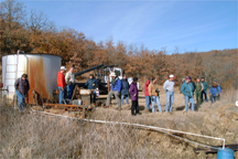
The Bureau of Indian Affairs has brought together agencies including the U.S. Geological Survey (USGS), the Environmental Protection Agency (EPA), and the University of Maine Water Research Institute (WRI) to collect information regarding the occurrence, distribution, and ecological and human health risks associated with dioxins, furans, and polychlorinated biphenyls (PCBs) in fish and sediment in the Penobscot River. The study area encompasses the main channel of the Penobscot River from the Milford Dam impoundment in Old Town to Grindstone, Maine. Concentrations of dioxins and furans in the riverbed sediment have been quantified to a limited degree through a sampling study conducted in this area in 1995 by the Penobscot Nation's Department of Natural Resources. In addition, the Maine Department of Environmental Protection (MDEP) presently maintains several fish sampling stations in the study area as part of their statewide dioxin program. The USGS will compile the data that the project generates on dioxin, furan, and PCB that will then be reviewed and interpreted by EPA. Contact: USGS District Chief, Robert Lent (water issues), 207-622-8201, rmlent@usgs.gov ; USGS Columbia Environmental Research Center (wildlife issues), 573-875-5399, bill_mauck@usgs.gov
South Florida Ecosystem Program.
The concerns of the Seminole Tribe of Florida and Miccosukee Tribe of Indians of Florida are integral to the health and management of the Everglades. The Miccosukee and Seminole Tribes, with the USGS and other agencies, participate cooperatively on the South Florida Ecosystem Restoration Working Group. The working group identifies research needed for wise management of the area. The USGS conducts research to help other entities with their water-management decisions. Current USGS research in support of the working group focuses on: water flow and management issues; landscape ecology; wetland ecology; fire ecology; ornithology and ichthyology; coral reef ecology; and long-term monitoring.
As part of the Everglades Restoration Program, the U.S. Army Corps of Engineers and the South Florida Water Management District (SFWMD) propose modifying water deliveries to tribal lands, Big Cypress National Preserve (National Park Service), and other areas located in the interior of the Everglades. The proposed modified water deliveries are designed to provide net flood protection and water delivery benefits to agricultural lands, as well as partial restoration of historic ecological conditions within both Seminole and Miccosukee tribal lands. The effects that these proposed water delivery changes will have on tribal lands can be determined only if interior flows are accurately known.
The Everglades Construction Project, developed as a result of the Everglades Restoration Program, required diversion of the surface water from a specific basin into a storm treatment area. This diversion will cause changes in the portion of the water subject to tribal entitlement. The project utilizes the individual strengths of the three entities (the Seminole Tribe, the SFWMD, and the USGS) that coordinate its operation. The USGS collects and analyzes data on surface-water flows. Implementation and development of strategically located streamflow gaging sites will help define future surface-water flow requirements. Accurate flow calibrations are generated from data collected at these sites. Subsequent studies can be conducted by other agencies to compute nutrient and other contaminant loadings based on the calibration information. That information, in turn, can be used to manage the canal system. Providing continuous flow data at selected impact points for interior basins will also complement the existing eastern flow canal discharge network and allow more accurately timed surface-water releases.
The USGS operates and maintains two gages in cooperation with the Seminole Tribe and the SFWMD. Acoustic velocity meters systems (AVM) at the two sites are calibrated to the flow and used to compute discharge. The Seminoles are responsible for servicing, operating, and maintaining flow-weighted nutrient autosamplers at the same sites, activated by these AVM's. The samples are sent to the USGS for analysis. The SFWMD provides real-time data transmission support by servicing the radio frequency/cell phone telemetry infrastructure located at each of the two gaging sites. Furthermore, the SFWMD is responsible for combining the flow data with nutrient sample data to determine total nutrient loads. These combined data are disseminated in several annual "load" reports. The final discharge data are also published in the annual USGS Water Resources Data Report, v. 2a. One gage was operated in cooperation with the Miccosukee Tribe. At the end of FY 1999, that part of the project was modified so that the Miccosukee Tribe currently operates equipment within the structures built by the USGS. Contact: Mitch Murray, 305-717-5827, mmurray@usgs.gov (water issues), or Florida Caribbean Science Center, 352-378-8181, russell_hall@usgs.gov (ecology issues)
Study of Environmental Contaminants.
USGS scientists completed a final report summarizing four years of baseline water quality and toxicology monitoring and submitted it to the Sokoagon Chippewa Community, Mole Lake Reservation. Walleye and wild rice are the principal cultural and economic resources of the Mole Lake Band. USGS biologists exposed walleye fry and wild rice seedlings to various concentrations of heavy metals to establish baseline toxicity thresholds for metals. An ancillary study concerned the use of bryophytes (mosses, liverworts, and hornworts) for monitoring heavy metals uptake and the effects of copper and sulphate on wild rice in the Swamp Creek Basin. The bryophyte study was completed for the Great Lakes Indian Fish & Wildlife Commission (GLIFWC). All tests were conducted using water and organisms collected and shipped from Mole Lake or organisms cultured in Mole Lake water. All work on this project has been completed. Contact: Mid-Continent Ecological Science Center, 970-226-9100, lee_ischinger@usgs.gov
Historical Ecosystem Reconstruction and Potential Identification of Effects of Past Ecosystem Perturbations in Lac Courte Oreilles.
This project is reconstructing the Musky Bay ecosystem history of, and an additional site within, lands of the Lac Courte Oreilles Band of Lake Superior Chippeaw Indians, with special emphasis on the possible effects of cranberry farming and shoreline development using the sediment record. Studies are focusing on the nutrient history (input and burial rates) that reflect management practices and possible watershed degradation. The modeled nutrient history will be interpreted in concert with reconstructed algal (mainly diatom) communities preserved in the sediments. Another objective of the project is to search for possible cranberry farming signatures including sulfur, uranium, and potassium associated with fertilizers, and copper associated with pesticides. Biogenic silica profiles will provide complimentary data for algal community reconstructions. The sediment record likely preserves observable trends in nutrient biogeochemical cycling and ecosystem character over the last few hundred years, a time that includes a background period and the period of cranberry farming. Contact: Faith Fitzpatrick, 608-821-3818, fafitzpa@usgs.gov
Water Quality Monitoring of Menominee Lands.
The Menominee Indian Tribe of Wisconsin is gathering information on current water quality and biotic conditions of the Wolf River within the Menominee Reservation, including the presence or absence of contaminants in water, sediments, and biota. The USGS is providing information as part of a project to develop a set of baseline data for the Menominees. This database was designed to determine the concentrations of specific trace elements in water-column samples and in samples of fish livers, caddisfly larvae, and fine streambed sediments at the sampled sites. A final USGS report describing the results from the baseline monitoring of water quality near the upstream and downstream boundaries of the Menominee lands will be published during fiscal year 2001. The USGS also began a new year-long study to collect similar data on water quality and biotic conditions at 10 additional sites on Wolf River tributaries. Contact: Garn Garn, 608-821-3838, hsgarn@usgs.gov
Oneida Hydrologic Investigations.
The Oneida Tribe of Wisconsin is concerned about the effects of building development and agriculture on the drinking water quality of Tribal members. The USGS is assisting the Oneida Tribe by compiling and presenting information on water quality at two sites on Oneida lands. In FY2000, the USGS collected water quality samples from two streams. The headwaters of one stream are in an area of heavy row crop production. The other stream has a naturally producing cold-water source in its headwaters and is in an area of rapid development. Because of these factors, both of these sites are of a major interest to the Oneida government. Samples were analyzed for nutrients, pesticides, and suspended sediment concentration and will be used to perform trend analysis. This is intended to be a long-term study, providing information to help the Oneida manage their water resources. Contact: Kevin Richards, 608-281-3861, krichard@usgs.gov
Water Quality of South Dakota Reservoirs.
USGS biologists are assisting in a study of the physical, chemical, and biological characteristics of Federal reservoirs in southwest South Dakota. The Oglala Sioux Tribe and the Cheyenne River Sioux Tribe are interested in results of these investigations since the results might influence the Bureau of Reclamation's management of the reservoirs. USGS is preparing a summary report on water quality in the reservoirs that analyzes all extant, available data. Contact: Columbia Environmental Research Center, 573-875-5399, bill_mauck@usgs.gov
Water Quality in Tar Creek and Spring River near Lands of Quapaw Tribe of Oklahoma.
The Picher Mining District of northeastern Ottawa County, Oklahoma was the site of mining for lead and zinc from about 1900 until 1970. Mining in the area has decreased substantially since the 1950's. By the 1980's, approximately 2,900 acres of land were overlain by large piles of gravel-sized tailings of limestone and chert with traces of metallic-sulfide minerals. Drainage from these piles, as well as from mine openings, has lead to substantial metals contamination of Tar Creek and the Spring River near Miami, Oklahoma. The USGS and other agencies conducted water-quality and bed-sediment sampling in the area from the 1980's to early 1990's. The Quapaw Tribe of Oklahoma would like to obtain current data about the occurrence and distribution of metals, pesticides, volatile organic compounds, and other substances in surface water draining their lands to determine the current condition of those waters. Contact: William J. Andrews, 405-810-4416, wandrews@usgs.gov
| Osage-Skiatook Petroleum Field Conference. Two locations near Skiatook Reservoir on the Osage Reservation in northeast Oklahoma have been selected as Petroleum Environmental Research Project study sites. The USGS project will evaluate the effects of oil and gas production operations on soils and surface- and ground-water quality in the area. Skiatook Reservoir serves as flood control, water supply, and recreation for the city of Tulsa and adjacent areas. A November 2000 field conference brought together scientists and managers from government, tribal, and university backgrounds to tour the project sites and discuss the present and future effects of oil and gas development. The USGS, the Osage Nation, BIA, EPA, DOE, the Army Corps of Engineers, University of Oklahoma, University of Tulsa, and Oklahoma State University participated in the conference. Contact: Jim Otton, 303-236-8020, jkotton@usgs.gov |
 |
Surface-water Quality and the Effects of Oil Production, Osage Nation.
The USGS is continuing to cooperate with the Osage Nation to sample water-quality and measure stream discharge at 140 surface-water sites on the Osage Reservation. The study is also identifying the oil wells upgradient from the sampling sites using a digital elevation model. Water-quality data will be compared to oil-well information for upgradient wells. Contact: Marvin M. Abbott 405-810-4411, mmabbott@usgs.gov
Monitoring of Water Quality in Iowa Tribal Lands, Central Oklahoma.
The Iowa Tribe of Oklahoma is concerned about the quality of ground and surface water on Tribal lands in central Oklahoma. Possible sources of contaminants to water in the area include agricultural activities, ground-water/surface-water interactions with the Cimarron River, oil drilling, dump sites, and naturally occurring trace metals. The USGS, in cooperation with the Iowa Tribe of Oklahoma, sampled several sites to investigate possible water-quality problems caused by these sources. Ten domestic wells and eight surface-water sites were sampled for physical parameters, nitrate, chloride, uranium, and major pesticides to help identify the occurrence and distribution of pesticide contamination in waters underlying or draining Tribal lands. Contact: William J. Andrews, 405-810-4416, wandrews@usgs.gov
Caddo Aquifer Vulnerability.
The Caddo Tribe of Oklahoma is concerned about the vulnerability of ground water in northern Caddo County and Canadian County, Oklahoma, to pesticide contamination. On behalf of the Tribe, the USGS is constructing an aquifer sensitivity map to outline areas where the aquifer is susceptible to pesticide contamination. The Tribe, with USGS assistance, is developing a geographic information system (GIS) that will include land use, pesticide use, and other data for parcels of land. USGS scientists will work with Tribal employees on ways to use the GIS resources to make ground-water vulnerability maps. Results will be made available in a report. Contact: Carol Becker, 405-810-4436, cjbecker@usgs.gov
Groundwater contamination on and near the Fort Peck Indian Reservation.
USGS hydrologists monitored two ground-water contamination situations on the Fort Peck Indian Reservation, on behalf of the Fort Peck Assiniboine and Sioux Tribes. In one case, salinewater is contaminating non-saline ground water in Quaternary deposits in the East Poplar oil field. In the other case, nitrate is contaminating the Flaxville and underlying aquifers. The USGS investigated the extent, magnitude, and movement of these two contamination issues and reported the results, to date, in Water-Resources Investigations Reports. Saline-water contamination in the East Poplar oil field may be as much as 12.4 square miles, may affect 9-60 billion gallons of ground water, and discharges to the Poplar River. The probable source of saline-water contamination is brine that is a by-product of the production of crude oil in the East Poplar oil field. In the other case, concentrations of nitrate equaled or exceeded 10 milligrams per liter nitrate as nitrogen in 84 percent of the wells completed in the Flaxville aquifer and dryland farming and livestock are the dominant sources of nitrate. The USGS collected additional data in these two study areas to investigate saline-water plume migration and seasonal nitrate trends. Data collection is now complete and final reports are being prepared. Contact: Joanna Thamke, 406-457-5923, jothamke@usgs.gov
Geohydrologic and Water-Quality Assessment of Pueblo of San Ildefonso Lands.
The Pueblo of San Ildefonso and the USGS are cooperating to evaluate the extent of environmental impacts on the geohydrologic system of the Pueblo of San Ildefonso and adjacent Federal lands managed by the Department of Energy (DOE) by using existing information derived from internal and external sources. The project is identifying the water-quality characteristics of water resources on Pueblo and adjacent DOE lands. It will also identify potential sources of pollution within the study area. The water-quality data from this study can be used by the Pueblo of San Ildefonso in developing its water-quality standards. A critical component of this project is training provided by USGS staff to Pueblo staff. The training will assist the Pueblo staff in developing their technical abilities to collect water data. At the conclusion of the study, the Pueblo will have increased independence in conducting the activities. Contact: Dale Rankin, 505-830-7965, drrankin@usgs.gov
| Geohydrologic and Water-Quality Assessment of Pueblo of Jemez Ancestral Lands. This study is evaluating the extent of environmental impacts on the geohydrologic system of the Upper Jemez River watershed from internal and external sources. The project is identifying the water-quality characteristics of water resources within the Jemez River watershed and point and nonpoint sources of pollution within the study area. The water-quality data can be used by the Pueblo in deciding among appropriate economic development alternatives. As part of this project, USGS staff will work with Pueblo staff to enhance the Jemez employees' technical ability to collect water data, thereby increasing the Pueblo's self-sufficiency so that Jemez employees can conduct assessment activities independently. Contact: Dale Rankin, 505-830-7965, drrankin@usgs.gov |
 |
Aquifer Sensitivity on Navajo Nation Lands and Ground-Water Vulnerability to Pesticide Contamination on the Navajo Indian Irrigation Project.
The primary objective of this study is to determine the sensitivity of aquifers to agricultural activities and attendant pesticide application occurring on the overlying land surface. The assessment of aquifer sensitivity on Navajo Nation lands will be based on an evaluation of the physical setting of the aquifers, including the overlying topography and geology, depth to water from the land surface, precipitation, and characteristics of the overlying soils. Digital data sets and GIS coverage describing these conditions will be some of the products of this study. Additionally, the project will assess ground-water vulnerability on the Navajo Indian Irrigation Project, including an evaluation of agricultural practices. These practices include how much and when irrigation water is applied. The use of pesticide products, as well as the amount, timing, and method of application of these products, will also be considered. Potential sources of data for this study include the Navajo Nation and its contractors, the USGS and other Federal natural-resource agencies, and State natural-resource agencies in Arizona, New Mexico, and Utah. Contact: Paul Blanchard, 505-830-7947, pblanch@usgs.gov
Aquifer Sensitivity on Navajo Nation Lands and Ground-Water Vulnerability to Pesticide Contamination on the Navajo Indian Irrigation Project.
The primary objectives of this study are to determine the sensitivity of aquifers to impacts from activities occurring on the overlying land surface, and to estimate the effects of irrigated agriculture and attendant pesticide use on ground water underlying the Navajo Indian Irrigation Project (NIIP). GIS coverages that describe recharge areas, areas of unconsolidated deposits, soil hydrologic group, topography, and precipitation have been developed. The aquifer sensitivity assessment will consist of combining these coverages and interpreting the resulting coverage. The assessment of ground-water vulnerability to pesticide contamination on the NIIP will consist of combining the results of the aquifer sensitivity assessment with pesticide leachability ratings for each pesticide used during 2000. Leachability ratings will be estimated on a field-by-field basis. Contact: Paul Blanchard, 505-830-7947, pblanch@usgs.gov
Geoenvironmental effects of the Glen Canyon Dam.
The environment in Grand Canyon has been degraded by the Glen Canyon Dam. The USGS is collaborating with other researchers to provide the Bureau of Reclamation with information for policy decisions concerning the management of water flow at the Glen Canyon Dam. Under the post-dam flow regime, which limits floods and impounds sediment, sandbars have degraded, campsites and riparian habitat have been lost, and species have become endangered. Congress passed the Grand Canyon Protection Act, requiring the Bureau of Reclamation to alter discharge from the dam to enhance the environment downstream in Grand Canyon National Park. Representatives of the Hualapai Tribe and Hopi Tribe are among more than two dozen stakeholders who regularly receive reports on the progress of this project from with USGS' Coastal and Marine team and the Grand Canyon Monitoring and Research Center. The USGS has provided marine survey technology including side-scan sonar, rotating sonar, seismic reflection profiling, and underwater video equipment. USGS scientists are interpreting sedimentary structures to provide explanations for sediment transport (particularly useful for determining sediment transport prior to the dam) and developing new approaches to sediment-transport modeling. Contact: David Rubin, 831-459-3156, drubin@usgs.gov
Climate Change and Land-Use Impacts, Navajo Nation and Hopi Tribe.
Sand dunes on the Navajo Nation in Arizona are being examined as indicators of climate change, and the potential of sand dune movement is being determined. This project, begun in Federal fiscal year 2000, consists of mapping sand dune deposits and classifying them according to stability, based on the degree and type of vegetation holding them in place, and on regional meteorological information. The mobility of sand dunes is important for determining potential impacts of sand encroachment on grazing and farming resources, native plants, and infrastructure. Project activities in FY 2000 included organizing and holding a workshop on the new Hopi Buttes study. The workshop provided a forum for community outreach and development of the study's focus with collaborators from Navajo Nation Department of Archaeology, Diné College, Department of Water Resources of the Hopi Tribe, Department of Natural Resources of the Hopi Tribe, Northern Arizona University, and various scientific disciplines within the USGS. Workshop participants also included representatives of the Navajo Nation's Environmental Protection Agency, BIA's Division of Water and Land Resources, and the Hopi Tribe's Minerals Department. A USGS scientist was invited to speak at the Navajo Nation's Shiprock Chapter GIS Conference and to participate in the Navajo EPA's strategic planning session. These projects emphasize outreach with the Native community, including the coordination of training sessions in image processing and acquisition of Landsat 7 imagery on the Navajo and Hopi Reservations. Contact: Margaret Hiza Redsteer, 303-236-0075, mhiza@usgs.gov
Wetlands on the Navajo Reservation.
USGS wetland scientists assisted in constructing a wetland environment on the Navajo Nation that will treat wastewater formerly impounded in a wastewater lagoon. The wetland will improve the quality of discharge water from Pinon, Arizona, and, at the same time, create excellent habitat for wildlife. This is a cooperative effort among the Navajo Nation, the Indian Health Service, Bureau of Reclamation, and the USGS. Researchers will analyze data obtained from monitoring the effectiveness of the wetland to determine the success of the project. The results of analysis will provide information on how and when to build additional wetland treatment cells for further development in the Pinon area. Contact: Mid-Continent Ecological Science Center, 970-226-9342, joan_thiebaud@usgs.gov
Sedimentation and Erosion on Navajo Lands.
The USGS is identifying sources and mechanism of sediment production on lands of the Navajo Nation. Parts of the investigation will estimate rates of hillslope, valley, and channel erosion in tributary drainage basins and sediment yields from drainage basins within the Navajo Partitioned Lands. Results of the study will help the Navajo Nation's land-use managers and residents assess the stability of channels, and the relative erodibility of valleys and hillslopes. A report was produced at the conclusion of this project in FY2000. Contact: John Parker, 520-670-6671, ext. 271, jtparker@usgs.gov
Alien Invaders.
Exotic plant species are invading lands in the Southwest, including Tribal lands. USGS scientists have developed a standardized methodology for compiling data collected in the field on infestations of invasive exotic plants. The Southwest Exotic Plant Mapping Program provides Tribes with the opportunity to contribute their field observations to a regional database. The regional database and maps made from the database can be used for inventorying, monitoring, and sharing data on exotic plant species. The Navajo Nation participated in this cooperative effort by contributing over 250 field observations to the regional database. Several sites on the Navajo Reservation have been used to implement the program. The effectiveness of methods to control the spread of exotic species on Navajo lands is being shared regionally by the Navajo Nation's contribution to the regional data and maps that are available on the program's web site. Contact: Colorado Plateau Field Station, 520-556-7466, ext. 235, kathryn_a_thomas@usgs.gov
Sedimentation of White Sturgeon Spawning Habitat, Kootenai River, Idaho.
In 1999, the USGS, in cooperation with the Kootenai Tribe of Idaho, began examining sedimentation in Kootenai River white sturgeon spawning habitat. The Kootenai River, second largest tributary to the Columbia River, has undergone many changes due to construction of dikes and Libby Dam. The operation of this dam has altered the river ecosystem, resulting in the decline of many resident fish populations including the Kootenai River white sturgeon (listed as an Endangered Species in 1994). One limitation to white sturgeon spawning success may be the change from the natural fluctuations in flow and sedimentation in sturgeon spawning areas resulting from the operation of the dam. This study will characterize the type of sediments composing the Kootenai River substrate/subbottom habitat. It will also assess changes in Kootenai River bed habitat characteristics, including trends in the variability of bed elevation during pre- and post-Libby Dam periods. Study tasks include a detailed survey of the substrate using marine seismic subbottom profiling systems and coring the upper 10 to 15 feet of substrate/sediments. These data are being integrated with data defining pre- and post-dam water-surface and riverbed elevations to develop a conceptual model describing the sedimentation history of the substrate habitat area. This integrated analysis will aid in characterizing how sedimentation processes in the river have changed over time and whether changes have affected the quality of the habitat area as it relates to spawning conditions. Contact: Gary Barton, 253-428-3600, ext. 2613, gbarton@usgs.gov
Mining Contamination.
Parts of the South Fork of the Coeur d'Alene River in Idaho have been contaminated by historic mining activity. The USGS has participated in the Coeur d'Alene Natural Resource Damage Assessment to ascertain the extent of injury. Of particular importance is determining any injury to ecosystems on lands of the Coeur d'Alene Tribe. Scientists are studying contamination from metals and other mining wastes released from the mine and providing technical support for litigation. Contact: Columbia Environmental Research Center, 573-875-5399, bill_mauck@usgs.gov
Western US Phosphate and the Shoshone-Bannock Tribes.
The eastern half of the Fort Hall Reservation, home of the Shoshone-Bannock Tribes and part of the Southeast Idaho Phosphate Resource Area in the Western Phosphate Field, is included in the study area of the USGS project "Geologic and Geoenvironmental Studies of the Western Phosphate Field." Although the project was initially focused on delineating additional resources, research efforts have been extended to include multidisciplinary, geoenvironmental studies of selenium. Selenium, an element released from phosphate waste piles, is known to have had a detrimental effect on local livestock. Study areas include the Gay Mine, one of the largest open-pit mines in southeastern Idaho, operated by J.R. Simplot and FMC on the Shoshone-Bannock lands from 1946 to 1993. The site consists of numerous mine pits, waste dumps, and mill shale piles spread over an area of nearly 25 square miles. USGS involvement in fiscal year 2000 consisted of initial contacts and meetings with the Bureau of Indian Affairs (BIA) and the Tribal Land Use Committee, visits to the Gay Mine site, and geologic mapping in support of resource estimates for the Chesterfield Quadrangle. Samples were also collected for chemical and petrographic analysis. In addition, both the BIA and the USGS have been participants in regular meetings of the Interagency Area-Wide Technical Group and the Selenium Working Group Advisory Committee. Contacts: James R. Hein, 650-329-5287, jhein@usgs.gov; Sam Hernandez, BIA, 208-238-2305, samhernandez@bia.gov; Dan Christopherson, Shoshone-Bannock Tribes, 208-478-3808, wildlife@cyberhighway.net; Curtis Farmer, Chairperson, Tribal Land Use Committee, Shoshone-Bannock Tribes, 208-478-3891
Monitoring Movement of Pesticides on Shoshone-Bannock Tribal Lands.
The USGS, in cooperation with the Idaho Soil Conservation Commission (representing the Shoshone-Bannock Tribes), began a project in FY 1999 to examine the migration and persistence of two pesticides (1,3-Dichloropropene and Metam-Sodium) and their degradation products through soil at selected field locations on the Fort Hall Indian Reservation. The study used or adapted existing procedures to collect soil samples from multiple depths in selected fields; samples were collected before and after pesticide applications. Personnel from the Shoshone-Bannock Tribes, Idaho Soil Conservation Commission, National Resources Conservation Service, Idaho State Department of Agriculture, and USGS cooperated to complete objectives of the project. The project will be completed before March 2001, and a report on the study will be available through the USGS Idaho District web site, http://idaho.usgs.gov/public/reports.html. Contact: Deb Parliman, 208-387-1326, parliman@usgs.gov
Cui-ui in Pyramid Lake, Nevada.
The cui-ui is an endangered fish of the sucker family that is found only in Pyramid Lake, Nevada. The Pyramid Lake Paiute Tribe and other Northern Paiutes historically relied upon annual spawning runs of cui-ui for food. Since the Tribe controls use of Pyramid Lake and fully supports efforts to restore the cui-ui population, the Tribal Council has passed resolutions prohibiting harvest of cui-ui by non-Indians and Tribal members. The USGS is studying the population dynamics and reporting results to the Tribal Chairman. Adult cui-ui are netted at the south end of Pyramid Lake in the spring and are marked to determine the mortality rate. Fish are recaptured in the fall at selected stations around the lake to determine juvenile population size and estimate mortality over the summer. Contact: Western Fisheries Research Center, Reno Field Station, 702-784-5451, gary_scoppettone@usgs.gov
Organochlorine Compounds and Mercury in Fish Tissue from Lake Roosevelt and the Upper Columbia River, Confederated Tribes of the Colville Reservation.
The presence of organochlorine compounds, such as PCBs, dioxins, and furans, and mercury in fish of Lake Roosevelt has been well documented. Consequently, there have been concerns about the effects of local fish consumption on human health. Health advisories regarding consumption of Lake Roosevelt fish have been issued by the Washington State Department of Health. However, changes in industrial discharges to the Columbia River have been made in recent years, and one report has described decreases in concentrations of dioxins and furans in fish tissue. The Confederated Tribes of the Colville Reservation depend on Lake Roosevelt for subsistence fishing and for the economic benefits provided by non-Indian recreational use of the Lake. For this study, the USGS collected and analyzed selected fish tissues for concentrations of PCBs, dioxins, furans, and mercury. The results were statistically compared to work done several years before, showing that concentrations of these contaminants had either decreased or stayed the same over that time period. A report describing these results was published in early 2000. Contact: Mark Munn, 253-428-3600, ext. 2686, mdmunn@usgs.gov
Work Plan to Study the Presence and Transport of Contaminants in Sediment of Lake Roosevelt and the Upper Columbia River, Confederated Tribes of the Colville Reservation.
The presence of organochlorine compounds (such as PCBs, dioxins, and furans) and mercury in the sediment of Lake Roosevelt and the Upper Columbia River is well known. The U.S. Bureau of Reclamation supported a project in which the USGS worked with the Confederated Tribes of the Colville Reservation to create a description of work needed to identify the spatial distribution of these contaminants in the lake and river sediments. The product of this cooperative effort is a plan that also identifies the need for information about how sediment is transported through the system. Contact: Mark Munn, 253-428-3600, ext. 2686, mdmunn@usgs.gov
Yakima River Basin Stream Quality and Biological Communities.
The lands of the Confederated Tribes and Bands of the Yakama Indian Nation encompass more than 100,000 acres of intensively irrigated land within the Yakima River Basin. Agricultural runoff from the Yakama Nation has been assessed during this project, along with similar data from the rest of the basin's agricultural areas to determine the effect of different irrigation methods and agricultural practices on surface water quality. The National Water Quality Assessment (NAWQA) program has worked cooperatively with personnel from the Yakama Nation's Department of Natural Resources. Small- and intermediate-sized agricultural drainages within the Yakama Nation were added to the NAWQA sampling network. In addition, chemical suites from routinely sampled sites were augmented with NAWQA pesticide and trace element determinations to characterize agricultural return flow at the mouths of tributaries to the Yakima River. A ground-water sample was collected to measure emerging contaminants, including pharmaceuticals that may be entering the shallow groundwater from combined animal feeding operations. Sampling small- and medium-sized agricultural drainages was undertaken in October 2001, during minimal-flow conditions, for the purpose of measuring chemicals entering streams from shallow groundwater. Results will be compared with results of samples taken during other flow conditions. Contact: Greg Fuhrer, 503-251-3231, gjfuhrer@usgs.gov
Contaminated Chinook Salmon.
The Department of Energy's Hanford Laboratory in Washington State has become a nuclear waste disposal area. Tribes in the region, including the Confederated Tribes and Bands of the Yakama Indian Nation, the Confederated Tribes of the Umatilla Reservation, and the Nez Perce Tribe of Idaho, are concerned that chromium leaking from the site might adversely affect chinook salmon. USGS biologists have simulated conditions of the Hanford Reach of the Columbia River in Washington in the laboratory to study impacts under various exposures. Research began on this project in FY1999 and is continuing. Contact: Columbia Environmental Research Center, 573-875-5399, bill_mauck@usgs.gov
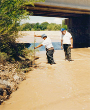
Suspended Sediment in the Lower Dungeness River.
The objective of this study is to characterize and quantify suspended sediment in the lower Dungeness River. The results will help Jamestown S'Klallam Tribal scientists in their study of elevated fecal coliform concentrations found in fine-grained sediments in Dungeness Bay. Daily suspended-sediment discharge and stream temperature are collected at two sites and particle size analysis is performed on selected samples. The results are published in the USGS Annual Data Report for Washington. Contact: Johnna Sheehy, 253-428-3600, ext. 2676, jlsheehy@usgs.gov
Southwest Washington Coastal Erosion Study.
This cooperative project between the USGS and Washington State uses fundamental and applied studies to develop a regional perspective and understanding of coastal processes, sediment transport, and associated shoreline changes. The study is examining the effects of man-made influences (enhanced runoff, dredging operations, Columbia River dams) and natural processes (climate variability, subsidence caused by earthquakes, coastal dune development) on sediment budgets and on the long-term shoreline change trends of the southwest Washington coast. As part of this project, the USGS and the Army Corps of Engineers jointly funded a study of coastal erosion on lands of the Shoalwater Bay Indian Tribe. Contact: Guy Gelfenbaum, 650-329-5483, ggelfenbaum@usgs.gov
Hydrogeologic Issues of the Shoalwater Bay Indian Tribe and Tokeland Peninsula.
The Shoalwater Bay Indian Tribe obtains water from an artesian aquifer (an aquifer that comes to the surface) underlying its lands and the Tokeland Peninsula that extends into Willapa Bay off Washington State. The Tribe is concerned about the effects of increasing population and commercial activities on the quantity and quality of water in the aquifer. Specific water-quality concerns include seawater intrusion, contamination from septic tanks, and contamination from pesticides applied in nearby forests. The USGS conducted a study describing the general hydrology and water chemistry of the aquifer, including concentrations of nitrate and selected pesticides. An interpretive report describing the findings was prepared. Contact: Gary Turney, 253-428-3600, ext. 2624, glturney@usgs.gov
Sediment Oxygen Demand in Upper Klamath and Agency Lakes, Oregon.
This study seeks to determine the magnitude and variability of sediment oxygen demand (SOD) in Upper Klamath and Agency Lakes. One aspect of the study will evaluate the change in SOD from before the development of summertime algal blooms to late summer, after or during the decline of the blooms. The study will also attempt to correlate SOD and other quantifiable sediment characteristics, in particular coarse/fine distribution, organic carbon content, and the residue lost on ignition. SOD is a critical component of the dissolved oxygen budget in the lakes, where low dissolved oxygen concentrations are detrimental to endangered sucker fish species of interest to The Klamath Tribes. Contact: Tamara Wood, 503-251-3255, tmwood@usgs.gov
Restoring Salmon in the Trinity River Basin.
USGS staff are involved in efforts to restore salmonid fisheries in the Trinity River Basin, California. This project, involving Tribal interests of the Hoopa Valley, Yurok, and Karuk Tribe of northern California, is a major inter-agency, inter-jurisdictional effort to restore a fishery decimated by water exportation and other land-use practices. USGS hydrologists are leading the effort to complete the Trinity River Flow Evaluation, produce the summary report, and make recommendations to the Secretary of the Interior on actions needed to restore the fishery. Contact: Jon Nowlin, 775- 887-7600, jonowlin@usgs.gov
Water Quality Sampling of the Taku River.
The Douglas Indian Association (DIA) initiated a grant from the Alaska Department of Environmental Conservation (ADEC) to fund a 5-year cooperative water-quality project. The purpose of the project is to collect baseline water-quality data for the Taku River, an important salmon fishery. The Taku River is subject to glacial "outbursts" that affect the River's water quality, though the watershed is undeveloped. The USGS is conducting the water-quality sampling and the USEPA is analyzing the samples. The DIA has provided an intern to assist USGS researchers with the sampling for at least part of the project. Contact: Bruce Bigelow, 907-586-7287, bbigelow@usgs.gov
Alaska Volcanoes and Alaska Natives.
Open communications between Alaska Natives and the USGS' Alaska Volcano Observatory (AVO) is crucial to help safeguard Alaskan communities. Numerous Alaska Native villages and corporations communicate with the AVO during periods of volcanic activity. Native officials transmit on-site observations to AVO, and AVO scientists distribute interpretive and hazards information to the Native communities. Many of these communities are on the AVO automatic weekly update fax and/or electronic mail lists that provide the status of activity of more than 40 active volcanoes in the Aleutian islands. All Native villages in the Aleutians, including Nelson Lagoon, Naknek, Unalaska, Akutan, False Pass, Atka, King Cove, are near active volcanoes. AVO also conducts geological field studies and services existing seismic-monitoring equipment to provide real-time warnings of volcanic activity and related hazards to aircraft and local communities. The USGS communications and research involved obtaining letters of non-objection for proposed volcano hazards work and accessing lands owned or selected by several Alaska Native corporations, including The Aleut Corporation, Akutan Corporation, Ounalashka Corporation, Ahtna Corporation, and Cook Inlet Region Incorporated. Contact: Thomas Murray, 907-786-7042, tlmurray@usgs.gov