| |
 Property Name Property Name- Stone Rock Bay, East
- MAS Number
- 0021210023
- Location
- 121D6, S28, 82S, 90E
- Land Status
- Federal
- Deposit Type/Commodities
- Dike REE
- Workings
- N/A
- Production
- N/A
- Significant Results
- Up to 1,445 ppb Au, 7,800 ppm Cu, 1,080 ppm U3O8,
14,400 ppm Ce, 7,230 ppm La
- Select References Bibliography,
NOTE: this document will open in a second browser window)
- Barker et al, 1989
- Property Name
- Stone Rock Bay, North
- MAS Number
- 0021210085
- Location
- 121D1, SW8, 82S, 90E
- Land Status
- Federal
- Deposit Type/Commodities
- Porphyry: Cu, Mo
- Workings
- P(s), diamond drill holes
- Production
- N/A
- Significant Results
- Select samples of silicified monzonite contained
up to 214 ppb Au, 6,206 ppm Cu, and 259 ppm Mo
- Select References (Full Bibliography,
NOTE: this document will open in a second browser window)
- N/A
- Property Name
- Stone Rock Bay, Central
- MAS Number
- 0021210086
- Location
- 121D1, SW8, 82S, 90E
- Land Status
- Federal
- Deposit Type/Commodities
- Vein: Au, Cu, Mo, Pd
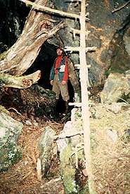
- Workings
- Adit: 21m; shafts: (both flooded)
- Production
- N/A
- Significant Results
- Vein up to 208 ppb Au, 6,949 ppm Cu, 928 ppm Mo,
315 ppb Pd
- Select References (Full Bibliography,
NOTE: this document will open in a second browser window)
- N/A
- Property Name
- Stone Rock Bay, West
- MAS Number
- 0021210087
- Location
- 121D1, SE7, 82S, 90E
- Land Status
- Federal
- Deposit Type/Commodities
- Porphyry: Cu, Mo
- Workings
- Adit: 3.7m
- Production
- N/A
- Significant Results
- Up to 113 ppb Au, 238 ppm Cu and 17 ppm Mo
- Select References (Full Bibliography,
NOTE: this document will open in a second browser window)
- N/A
Primary Magmatic
Deposit Map | Ketchikan Mining District Map
| Home
|