
The map and accompanying report cover part of the Noatak River drainage system in the western Brooks Range of northern Alaska. The surficial map units are primarily deposits created by late Quaternary glacial, glacio-lacustrine, and fluvial processes, but smaller alpine features such as talus, rock glaciers, fans, and cirque-glacier deposits are also shown. An unusual feature of the map is designation of bedrock surface forms such as glacier-scoured bedrock, which indicates former glacier extents and flow directions, and erosional rock surfaces, which were created by downcutting of rivers or glacial meltwater streams. The glacial deposits record five principal advances of middle and late Pleistocene age that flowed primarily southward from the rugged DeLong Mountains into the Noatak valley center. These advances blocked the Noatak River, causing a succession of glacier-dammed lakes to form. The lake deposits are correlated by degree of postglacial modification and by distinctive upper limits that represent former surface levels. The lacustrine and glacial records can be interrelated by features such as wave-cut notches on the inner flanks of moraines and by outwash trains that merge with deltaic deposits. Following deglaciation, downcutting by the Noatak River and its principal tributaries created extensive sets of alluvial terraces that continued to develop through much of Holocene time. |
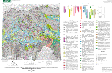 |
| This illustration
is a .gif (GIF) non-navigable image of the USGS geologic-map plot of the
Noatak National Preserve |
| File
Name |
File
Type and Description |
File
Size |
| README's
and METADATA |
||
| Text version of readme file that explains how to use the digital database |
4 KB |
|
| Text file of the FGDC-compliant metadata |
44 KB |
|
| DATA |
||
| Compressed tar file of the digital database for this map |
988 KB |
|
| FILES
for VIEWING and PLOTTING |
||
| Encapsulated PostScript file used for plotting a paper copy of the map | 9.4
MB |
|
| PDF file of map sheet that can be used for viewing map in a browser, as well as for plotting | 2.3
MB |
|
| PDF file of the pamphlet that accompanies this map | 128 KB |
|
This report is available only on the Web