U.S. Dept Commerce/NOAA/NMFS/NWFSC/Publications
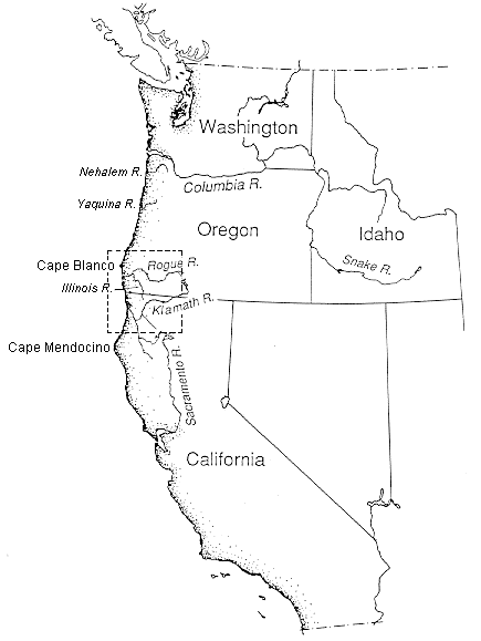
Figure 1.--Location map of Illinois River, Oregon. See Figure 2 for detail.
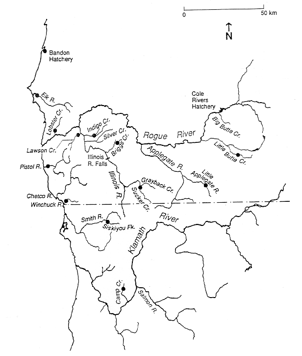
Figure 2.--Collecting sites in the Rogue River basin and surrounding area for samples used in the
genetic analysis. Collections were also made in the Smith and Klamath Rivers in northern
California, and Yaquina and Nehalem Rivers in northern Oregon
(Table 12).
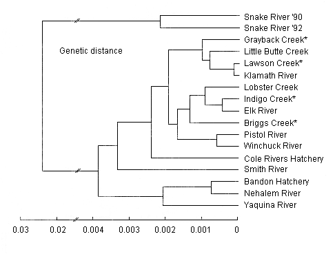
Figure 3.--Dendrogram depicting genetic relationships between coastal steelhead populations analyzed
for this study. The figure was constructed by clustering of Nei's (1978) unbiased genetic
distance values between pairs of samples. The four Illinois River samples are denoted by
asterisks (*). Note the change of scale involving genetic distances to samples from the
Snake River, which were included to provide a comparison with inland steelhead
populations.
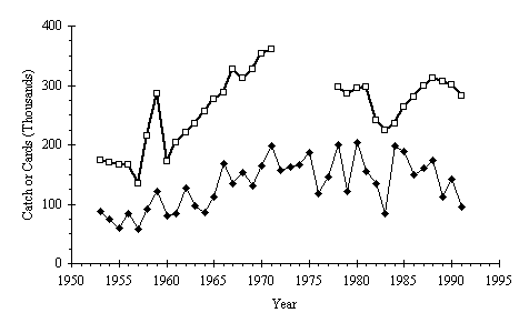
Figure 4.--Oregon statewide total angler fishing effort and steelhead catch. Effort is indexed by
annual salmon-steelhead punchcards issued (heavy line, squares). Catch (thin line,
diamonds) is statewide total, all runs. Effort for 1972 to 1977 omitted because reported
totals include daily punchcards in addition to annual punchcards. Based on data from Koski
(1963), Phelps (1973), Berry (1983), and ODFW (1992b).
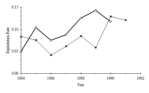
Figure 5.--Winter steelhead exploitation rates for the upper North Umpqua River (heavy line, squares)
and upper Rogue River (thin line, diamonds). Rates are calculated as the ratio of angler
catch to total run size estimated from adult dam passage counts, as in Kenaston (1989).
Catch data are from ODFW (1992b); passage counts for Winchester Dam (North Umpqua River)
are from Loomis and Liscia (1990); passage counts for Gold Ray Dam (Rogue River) are from
ODFW (1990) and ODFW (unpubl. data. 2501 SW First Avenue, P.O. Box 59, Portland, OR
97207).
Table of Contents